Gelephu Mindfulness City master plan
From BhutanWiki, the people's encyclopedia of Bhutan · places · Verified
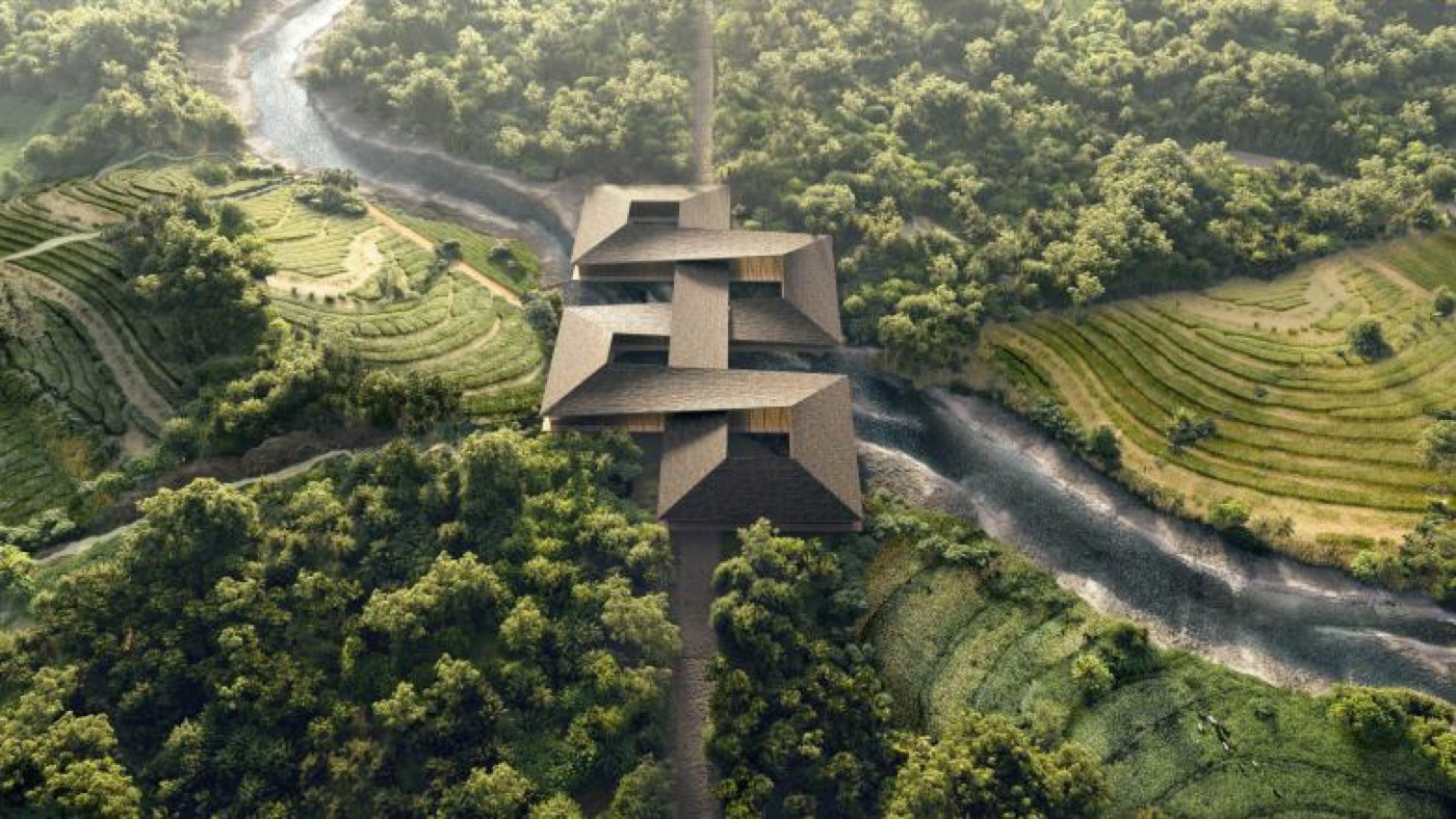
The Gelephu Mindfulness City master plan is the urban-design and architectural framework for Gelephu Mindfulness City (GMC), a special administrative region planned for the plains of Gelephu in southern Bhutan, near the Indian border. It was prepared by the Danish architecture studio Bjarke Ingels Group (BIG) with the engineering and planning consultancies Arup and Cistri, and was unveiled on 21 December 2023, during Bhutan's 116th National Day, after King Jigme Khesar Namgyel Wangchuck announced the project.[1]
The plan covers a site of more than 1,000 km² and is structured around eleven neighbourhoods laid out on mandala principles, linked by what the designers call "inhabitable bridges" that cross the rivers running through the area. Each bridge is intended to combine transport infrastructure with a civic or cultural use. The brief is tied explicitly to Gross National Happiness (GNH), with built features meant to represent the philosophy's nine domains.[2]
The master plan should be read alongside the legal and economic framework set out separately. It does not by itself establish the region's autonomy; that derives from the royal decree and the Royal Charter granted in December 2024.
Background
Gelephu sits in Sarpang District on the southern belt of Bhutan, a low-lying area of paddy fields and rivers close to the Indian state of Assam. The choice of a southern lowland site, rather than the mountain valleys where most Bhutanese towns developed, allows a flatter and more developable terrain and proximity to cross-border trade and air links.
The King commissioned a consortium led by BIG. Arup acted as the engineering and sustainability consultant and Cistri as the economic and urban planning adviser; later disclosures of the project team have also listed the Thai developer MQDC, the aviation consultancy NACO, and the consultancies CDR and ERM.[2] The master plan was published as a set of renders and planning diagrams rather than as a fixed construction blueprint, and BIG has described the scheme as one that will evolve over decades.
The master plan and BIG design
BIG organised the site around its natural drainage. The studio counted 35 rivers and streams crossing the area, carrying water from the mountains in the north down toward the southern plain.[2] Rather than channel or build over these watercourses, the plan keeps them as the structuring element, with development settling into the land between them.
The eleven neighbourhoods are each composed using the geometry of the mandala — repeating building types arranged symmetrically around a central public space. Density rises from north to south: small buildings dispersed in the landscape near the mountains give way to larger footprints and a more urban grain toward the southern edge.[3] Paddy fields are retained along the rivers, doubling as monsoon flood buffers and as wildlife corridors between the neighbourhoods.[1]
Inhabitable bridges
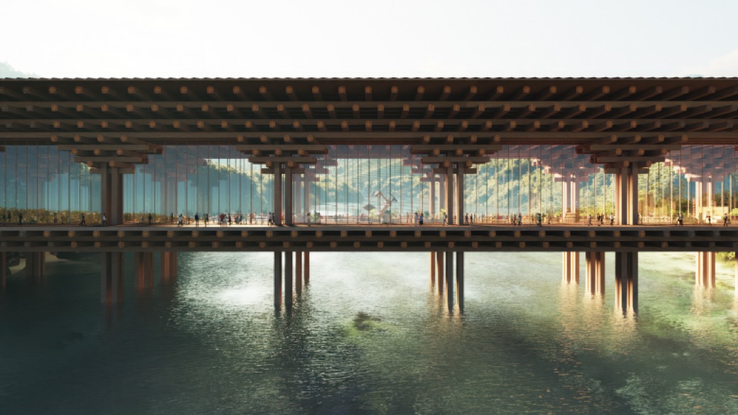
The most distinctive idea in the plan is the inhabitable bridge. Because rivers separate the neighbourhoods, the crossings between them become buildings in their own right — structures that carry roads, public transport and pedestrians while also housing a public institution. BIG has compared the role of these structures to that of the traditional Bhutanese dzong, a fortress-monastery that combined civic, religious and defensive functions in one building.[3]
Published descriptions assign each bridge a programme. Among those named are a Vajrayana Buddhist spiritual centre, a healthcare centre, a university, a greenhouse, a cultural centre, a market hung with Bhutanese textiles, the international airport, and a hydroelectric dam.[1] The functions are meant to correspond to the nine domains of Gross National Happiness, so that the act of moving through the city brings residents into contact with health, education, culture, spirituality and the other measured dimensions of wellbeing.
The largest of these civic landmarks is the Sankosh Temple-Dam on the western edge of the site, a hydroelectric structure combining a dam with stairways, viewing landings and a temple. BIG has described it as a cascading landscape of steps that, like the cliffside monastery of Taktsang, would stand as a monument to a sustainable human presence on the land. The temple-dam ties the master plan to Bhutan's broader reliance on hydropower.[1]
Architecture and materials
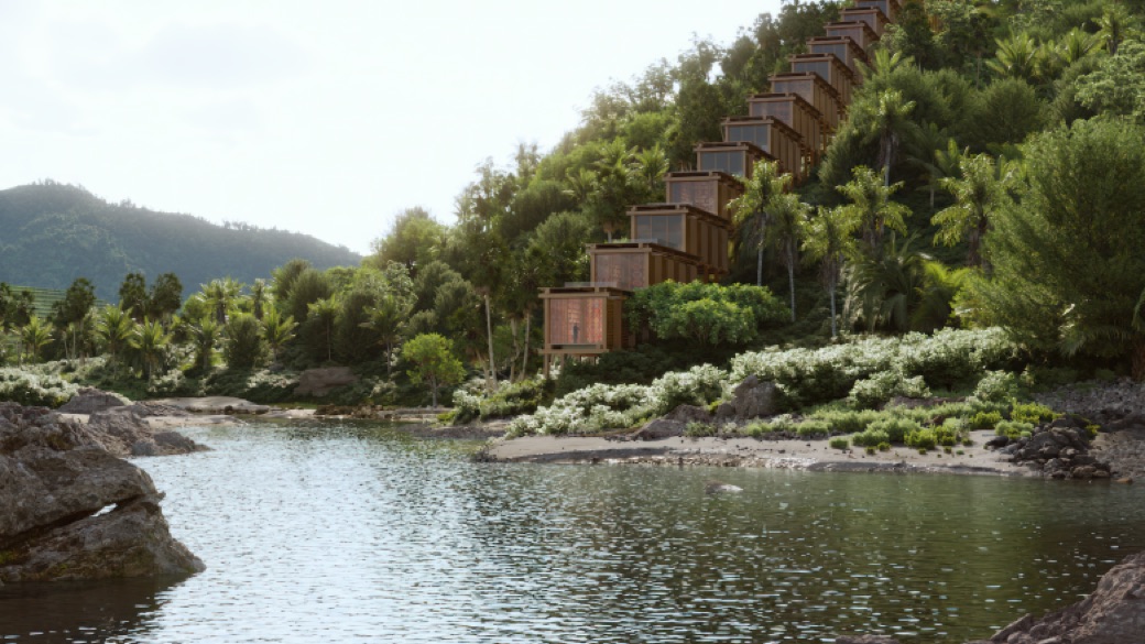
The plan calls for low-rise construction in natural materials — timber, stone and bamboo — together with permeable paving to manage rainwater.[4] Rather than impose a single architectural language, BIG proposed a vocabulary derived from traditional Bhutanese building, intended to be adapted for local builders so that the city would read as a continuation of Bhutanese craft rather than an import.
The Gelephu International Airport, also designed by BIG, is the clearest built expression of this approach. The roughly 68,000 m² terminal is framed in modular mass timber. BIG founder Bjarke Ingels has said the timber members are "carved and colored according to traditional craft" and carry dragon motifs representing Bhutan's past, present and future. A planted central courtyard, the Forest Spine, divides arrivals from departures and carries Bhutan's forest landscape into the building.[5] The airport was designed with the aviation consultancy NACO and is intended to anchor the master plan's transport network.
Landscape and GNH integration
The design treats landscape as the primary public realm. Keeping the rivers and paddy fields open is presented both as flood management and as a way of holding to GNH's environmental and cultural commitments. BIG has summarised the intent as a place "where nature is enhanced, agriculture is integrated, and tradition is living and breathing, not only preserved but also evolved."[2]
Sustainability claims have been central to how the project has been presented, including descriptions of a carbon-negative community echoing Bhutan's status as a carbon-negative country.[6] Such targets are design ambitions rather than measured outcomes; the renders and diagrams released so far set goals that construction will test. In 2025 the scheme received a Holcim Foundation Award for sustainable construction.[2]
Bjarke Ingels and the design team
Bjarke Ingels is a Danish architect who founded BIG in Copenhagen in 2006. The firm is known for large mixed-use and infrastructure schemes that fold public functions into single forms, an approach visible in the GMC bridges. For Gelephu, BIG led the master plan and designed the airport, while Arup provided engineering and sustainability consulting and Cistri advised on urban economics and planning.[1] The airport work was carried out with NACO and Changi Airport Planners and Engineers.[5]
Phasing
GMC is planned as a multi-decade build rather than a single construction campaign. Reporting on the project has described a first phase sized for roughly 100,000 residents, growing toward a long-term population of around one million, with staged development continuing through the 2030s.[7] Early physical work has centred on enabling infrastructure, with the airport among the first elements to move from design into construction. Because the master plan is a framework rather than a fixed scheme, individual neighbourhoods and bridges are expected to be designed in detail and built in sequence as the region develops.
References
- BIG designs Mindfulness City in Bhutan connected by "inhabitable bridges" — Dezeen
- Gelephu Mindfulness City — Bjarke Ingels Group (BIG)
- BIG unveils the master design of Gelephu Mindfulness City in Bhutan — Parametric Architecture
- BIG Unveils Gelephu's "Mindfulness City": Bridging Bhutan's Heritage and Future — ArchDaily
- Gelephu International Airport — Bjarke Ingels Group (BIG)
- BIG's mindfulness city in Bhutan envisions the world's first carbon-negative community — Designboom
- Inside Bhutan's Plan to Build a Mindfulness City — TIME
Related articles
Know something about this topic? Edit this article or . Anonymous contributions welcome — no account required.