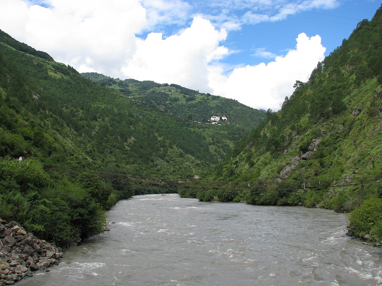

The Kuri Chhu (Dzongkha: ཀུ་རི་ཆུ) is one of the major rivers of eastern Bhutan, flowing through Lhuentse district and parts of Mongar district before joining the Manas River system at the southern border with India. With its headwaters originating in the high-altitude regions near the Tibetan border, the Kuri Chhu drains a catchment area of approximately 9,000 square kilometres and descends through some of the most remote and culturally distinctive terrain in the country. The river's name is believed to derive from "Kuri," referring to a local deity or place name in the region's oral traditions.[1]
The Kuri Chhu holds considerable economic significance as the site of the Kurichhu Hydroelectric Plant, a 60 MW facility completed in 2002 with Indian technical and financial assistance. Although modest in capacity compared to Bhutan's larger hydropower projects, the Kurichhu plant was among the first major power stations built in eastern Bhutan and demonstrated the viability of harnessing the region's rivers for electricity generation. The plant contributes to both domestic power supply and electricity exports to India under bilateral agreements.[2]
The valley of the Kuri Chhu is home to communities known for producing Bhutan's most prized textiles, particularly the intricate kushuthara (brocade) fabrics woven by women in villages along the river. Lhuentse district, through which the Kuri Chhu flows, is considered the ancestral homeland of the Bhutanese royal family, adding further historical resonance to this remote but culturally significant waterway.[3]
Geography and Course
The Kuri Chhu originates in the snow-capped mountains along the Bhutan-Tibet border in the northernmost reaches of Lhuentse district. Its upper tributaries flow through glacially carved valleys at elevations above 4,500 metres, passing through alpine meadows and scrublands before entering the dense coniferous forests that characterise the middle altitudes of eastern Bhutan. As the river descends, it passes through temperate broadleaf forests before reaching the subtropical zone in the southern foothills.[4]
The river's course is generally north-to-south, flowing through a steep-sided valley that narrows significantly in several gorge sections. The town of Lhuentse, the administrative centre of the district, sits on a ridge above the river, while the imposing Lhuentse Dzong occupies a promontory overlooking the Kuri Chhu valley. Below Lhuentse, the river continues southward through increasingly rugged terrain, joined by several tributary streams that drain the surrounding mountains.[5]
In its lower reaches, the Kuri Chhu flows through Mongar district before merging with other tributaries of the Manas system. The combined rivers cross into the Indian state of Assam, where they flow through the Manas National Park, a UNESCO World Heritage Site. The Kuri Chhu's waters ultimately contribute to the Brahmaputra River, one of the great rivers of South Asia.
Kurichhu Hydroelectric Plant
The Kurichhu Hydroelectric Plant is a 60 MW run-of-the-river hydropower station located on the Kuri Chhu near Gyalpozhing in Mongar district. The project was developed as a bilateral initiative between Bhutan and India, with construction carried out by the National Hydroelectric Power Corporation (NHPC) of India. Construction began in 1995, and the plant was fully commissioned in 2002 after the installation of four 15 MW Kaplan turbines.[6]
The plant was designed as a run-of-the-river facility, utilising a low diversion dam to channel water through a short headrace channel to the powerhouse. This design minimises the environmental footprint by avoiding the creation of a large reservoir, though it also means that generation capacity is constrained during low-flow periods in winter. The plant generates approximately 400 GWh of electricity annually, a significant portion of which is exported to India.[7]
The Kurichhu plant played an important role in extending reliable electricity supply to eastern Bhutan, a region that had historically been underserved by infrastructure. Revenue from the plant's electricity sales contributes to the Bhutanese government's budget, supporting public services including education and healthcare. The project also provided employment and skills training for local workers during its construction phase, contributing to economic development in the region.
Cultural Significance
The Kuri Chhu valley holds special significance in Bhutanese history and culture. Lhuentse district is regarded as the ancestral home of the Wangchuck dynasty, Bhutan's ruling royal family. Dungkhar, a village in the upper Kuri Chhu valley, is the traditional seat of the Dungkhar Chhoeje, the noble family from which the Wangchucks descend. This connection gives the Kuri Chhu valley a symbolic importance in the national narrative of Bhutanese statehood.[8]
The valley is equally renowned for its textile traditions. Women in villages along the Kuri Chhu are master weavers who produce some of the most complex and valuable textiles in Bhutan. The kushuthara, a ceremonial brocade fabric characterised by intricate supplementary weft patterns, is a specialty of the region. These textiles, which can take months to weave on traditional backstrap looms, are prized throughout Bhutan and are considered among the finest examples of Himalayan weaving. A single kushuthara of exceptional quality may be valued at tens of thousands of Bhutanese ngultrums.[9]
Lhuentse Dzong, which overlooks the Kuri Chhu, was originally constructed in the seventeenth century and serves as the administrative and religious centre of the district. The dzong houses a monastic community and is the venue for the annual Lhuentse tshechu, a festival of religious mask dances that draws pilgrims and visitors from across eastern Bhutan.
Ecology and Environmental Challenges
The Kuri Chhu basin supports diverse ecosystems across its altitudinal range. The upper catchment falls within or adjacent to several protected areas, including Bumdeling Wildlife Sanctuary to the north. The river and its tributaries provide habitat for fish species including the snow trout and golden mahseer, both of which are important for local subsistence fishing.[10]
Climate change poses significant challenges for the Kuri Chhu basin. Glacial retreat in the headwater regions threatens to alter the river's flow regime, potentially reducing dry-season water availability while increasing the risk of glacial lake outburst floods. The Bhutanese government has identified several potentially dangerous glacial lakes in the upper Kuri Chhu catchment and has undertaken monitoring and risk-reduction programmes with international support.
Flooding remains a periodic hazard in the Kuri Chhu valley. In 2004, a major flood event caused extensive damage to infrastructure and agricultural land along the river, displacing communities and disrupting the Kurichhu hydropower plant's operations. Such events underscore the vulnerability of riverside settlements and infrastructure to extreme hydrological events, a concern likely to intensify with climate change.[11]
References
- "Kuri Chhu." Wikipedia.
- "Kurichhu Hydroelectric Plant." Wikipedia.
- "Lhuntse District." Wikipedia.
- "Bhutan — Water Resources." Food and Agriculture Organization of the United Nations.
- "Lhuntse District." Wikipedia.
- "Kurichhu Hydroelectric Plant." Wikipedia.
- "Kurichhu Hydroelectric Plant." Wikipedia.
- "Lhuntse District." Wikipedia.
- "Bhutanese textiles." Wikipedia.
- "WWF Bhutan." World Wildlife Fund.
- "Kurichhu Hydroelectric Plant." Wikipedia.
Related articles
Know something about this topic? Edit this article or . Anonymous contributions welcome — no account required.